
Page 32 - Industrial Plants
P. 32
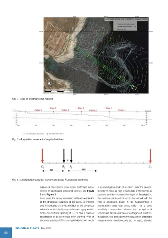
Fig. 2 - Map of electrode lines realized


          Fig. 3 - Acquisition scheme for longitudinal lines


          Fig. 4 - Multigradient array (C: Current electrode; P: potential electrode)

                             cables on the bottom, have been performed under   in an investigative depth of 55-60 m under the seabed.
                             control of specialized personnel (divers), see Figure   In order to have as high a resolution of the survey as
                             2 and Figure 3.                          possible and also increase the depth of investigation,
                             In our case, the survey was aimed to the reconstruction   the multicore cables will be laid to the seabed, with the
                             of the lithological variations of the sector of interest,   help of geologist’s divers. In the measurements a
                             and, in particular, to the identification of the calcareous   multigradient array was used, which has a good
                             substrate and to identify any cavities and highly karsted   sensitivity compromise between the perception of
                             areas. An electrode spacing of 5.0 m and a depth of   vertical and lateral variations of underground resistivity.
                             investigation of 55-60 m have been planned. With an   In addition, this array allows the acquisition of multiple
                             electrode spacing of 5.0 m, using 64 electrodes, results   measurements simultaneously (up to eight), allowing

            IndustrIal Plants - May 2022
    30